Wednesday Feb 22 Rain but no Sleet likely


Tues Feb 21
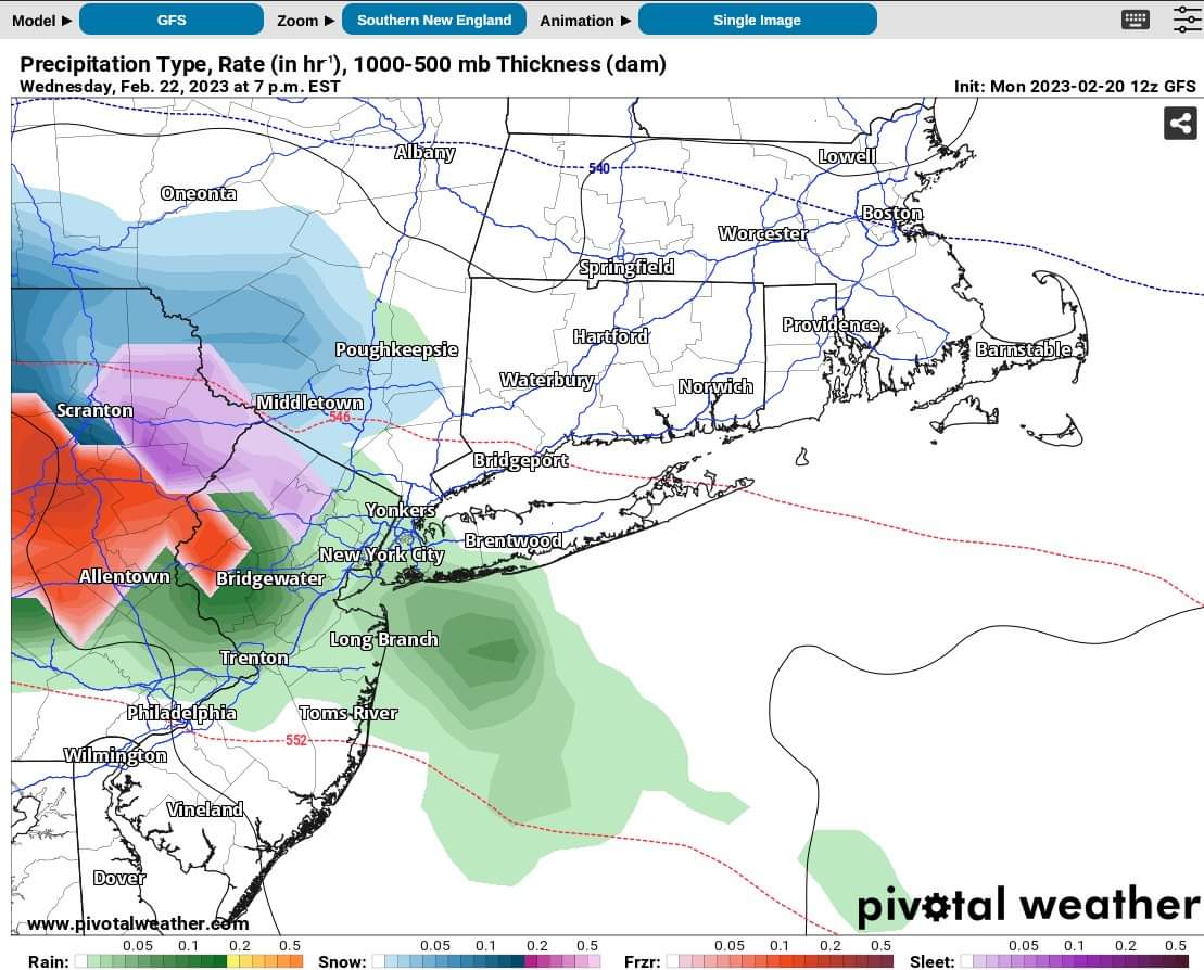
Wintery Mix less likely Wednesday.
Models have trended warmer over the last 24 hours, and overnight temps Wed into Thurs now look to leave the precipitation as all rain. Slight chance that there might be some mixing at the outset Wed afternoon but less likely and not expecting that to accumulate.
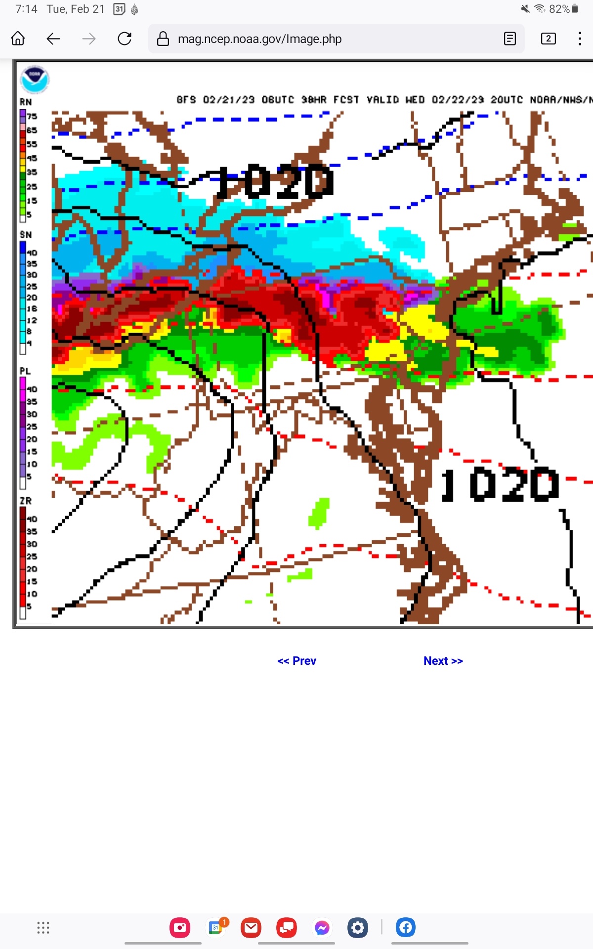
One note on timing, though. The start could come right around school dismissal, with cold rain and some sleet possible. The map below shows a worst case model output (most of the others are better than this) of moderate rain falling, temp has just risen above freezing, at 3:00pm Wednesday. I think there will be less rain and less chance of sleet than the GFS model shows this morning. There is *no* likelihood of a full on ice storm. The timing, though, is pretty consistent among the models in that there is likely to be some rain by 3:00.


High winds blew through Sussex County for about a half hour at the same time.
Wed, Feb 22
Rain likely this afternoon and tonight, most likely after 2pm


Sponsored Business


Promote your business here - Businesses get highlighted throughout the site and you can add a deal.
Employment Wanted
Latest Jobs
Employment Wanted
-
Math Tutoring with Certified Teacher
May 7, 2024 at 7:16pm
-
On call house cleaning service
May 6, 2024 at 7:17pm
-
May 6, 2024 at 10:11am
-
Experienced Summer Nanny Available: Thursdays & Fridays ;)
May 6, 2024 at 8:56am
-
Brazilian cleaning 973 776 2481
May 5, 2024 at 7:35pm
-
May 5, 2024 at 11:14am
-
May 4, 2024 at 1:08pm
Help Wanted
-
CF583 PT Nanny for 2 (July Start)
May 7, 2024 at 2:07pm
-
May 7, 2024 at 7:32am
-
May 3, 2024 at 2:32pm
Lessons/Instruction


Advertisement


Wednesday (Feb 22) evening mess.
As of this morning (Mon 2/20) the models are showing light rain that could change over to sleet or wintery mix after sunset on Wednesday and continue for a couple of hours, making driving conditions messy.
At this time there is no indication of freezing rain or an ice storm in the immediate area.
Temps are likely actually rise after midnight, and any remaining precipitation would then become rain and any accumulated sleet would likely melt by morning.