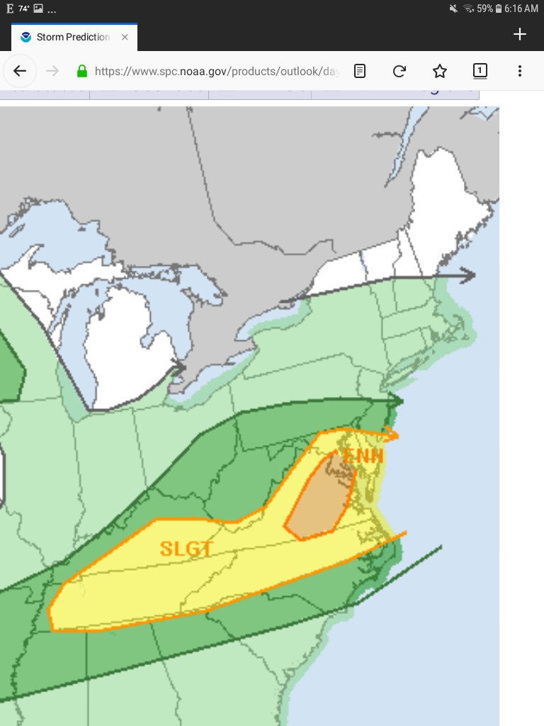
Revised Forecast for Tuesday, August 13th, 2019:

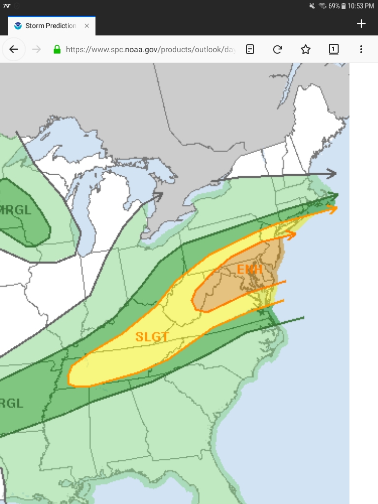
Just for reference, here is the previous severe weather outlook, from just last night. It had us in the yellow, and quite close to the orange "enhanced" zone.
From the NWS:
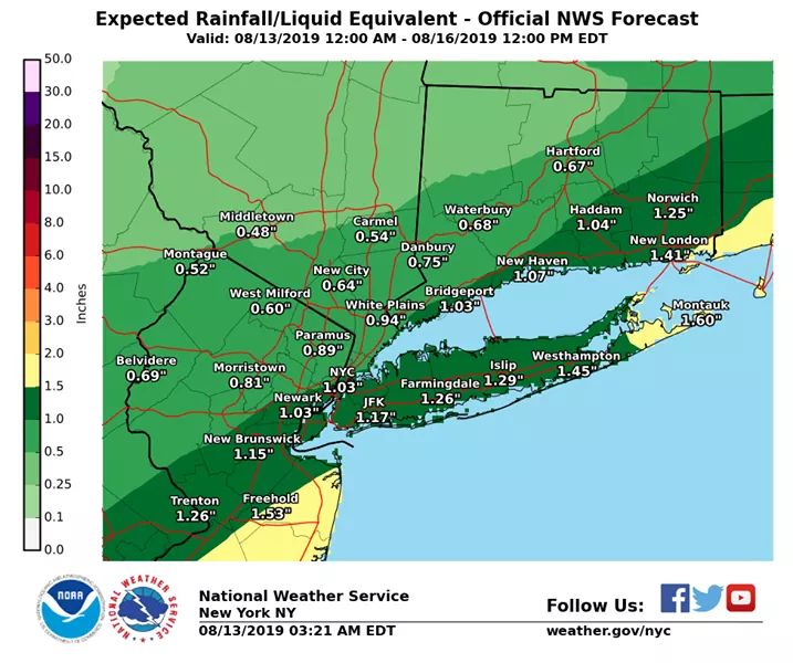
"Locally heavy rain is expected today into tonight. Rainfall amounts could vary quite a bit. Some areas could see well over an inch of rain, while other locations may see only light amounts."


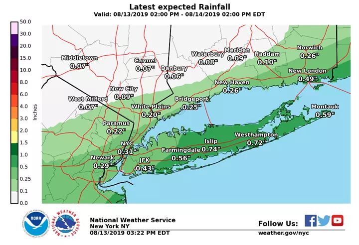
Latest update from the NWS:
The latest trends continue to push the heaviest rainfall to the south. Addition rain is expected to come as showers through the evening hours. Here is the latest forecast on amount expected.
Your post reminded me to bring a large umbrella to work. It was useful for keeping myself and a VIP dry during our walk to our lunch meeting today. 

For Sale


Garage Sales
-

HUGE Rummage sale to benefit the Bloomfield High School Robotics Team Sale Date: Apr 27, 2024
More info
Employment Wanted
Latest Jobs
Employment Wanted
-
(Classic Painting and Materials) Fair Prices. Spring and Summer Specials
Apr 25, 2024 at 5:14pm
-
Apr 25, 2024 at 8:08am
-
Apr 24, 2024 at 1:13pm
-
****Laundry + Bedrooms Organization : closets,drawers,shelves
Apr 24, 2024 at 8:04am
Help Wanted
-
Apr 25, 2024 at 6:15pm
-
PF504 FT Companion/FA for 16 Year Old (ASAP Start)
Apr 25, 2024 at 4:05pm
-
Apr 25, 2024 at 12:24pm
-
Part-time long term Nanny for toddler boy in Basking Ridge
Apr 24, 2024 at 7:49pm
-
PF802 FT M-Th Nanny for 2 (ASAP Start)
Apr 24, 2024 at 1:21pm
-
Photo Booth Attendant- Great for high school senior, college student, profeessional
Apr 24, 2024 at 5:55am
Lessons/Instruction

Advertisement


In the last 12 hours, the forecast guidence has moved the heaviest rain further south than was showing yesterday. There remains a chance of severe thunderstorms,, and a likelihood of heavy rain, but the chance of high winds, hail, or a real deluge is now lower here.
Still, pay attention to any alerts. I would not be surprised to see severe thunderstorm or flash flood watches this afternoon or evening. Timing, rain likely after 9 am with heaviest rain between 2 and 8 pm.